Откройте для себя мир авиации с помощью нового 3D-просмотра глобуса от AirNav Radar.
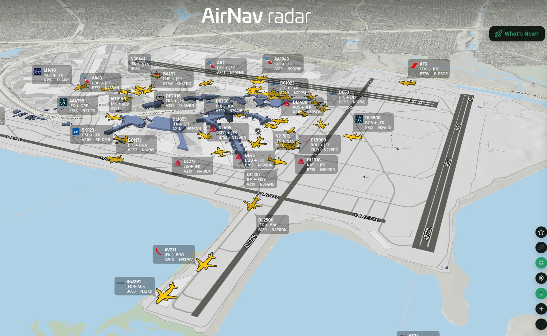
Нью-Йорк — Международный аэропорт имени Джона Ф. Кеннеди в 3D
Мир отслеживания полетов получил совершенно новый ракурс. AirNav Radar представил новый 3D-глобус , предоставляющий пользователям совершенно иной способ изучения мира, аэропортов, самолетов и текущей ситуации с полетами. Вместо просмотра самолетов на традиционной плоской карте теперь можно переключиться на трехмерный глобус и исследовать авиацию с более захватывающей перспективы.
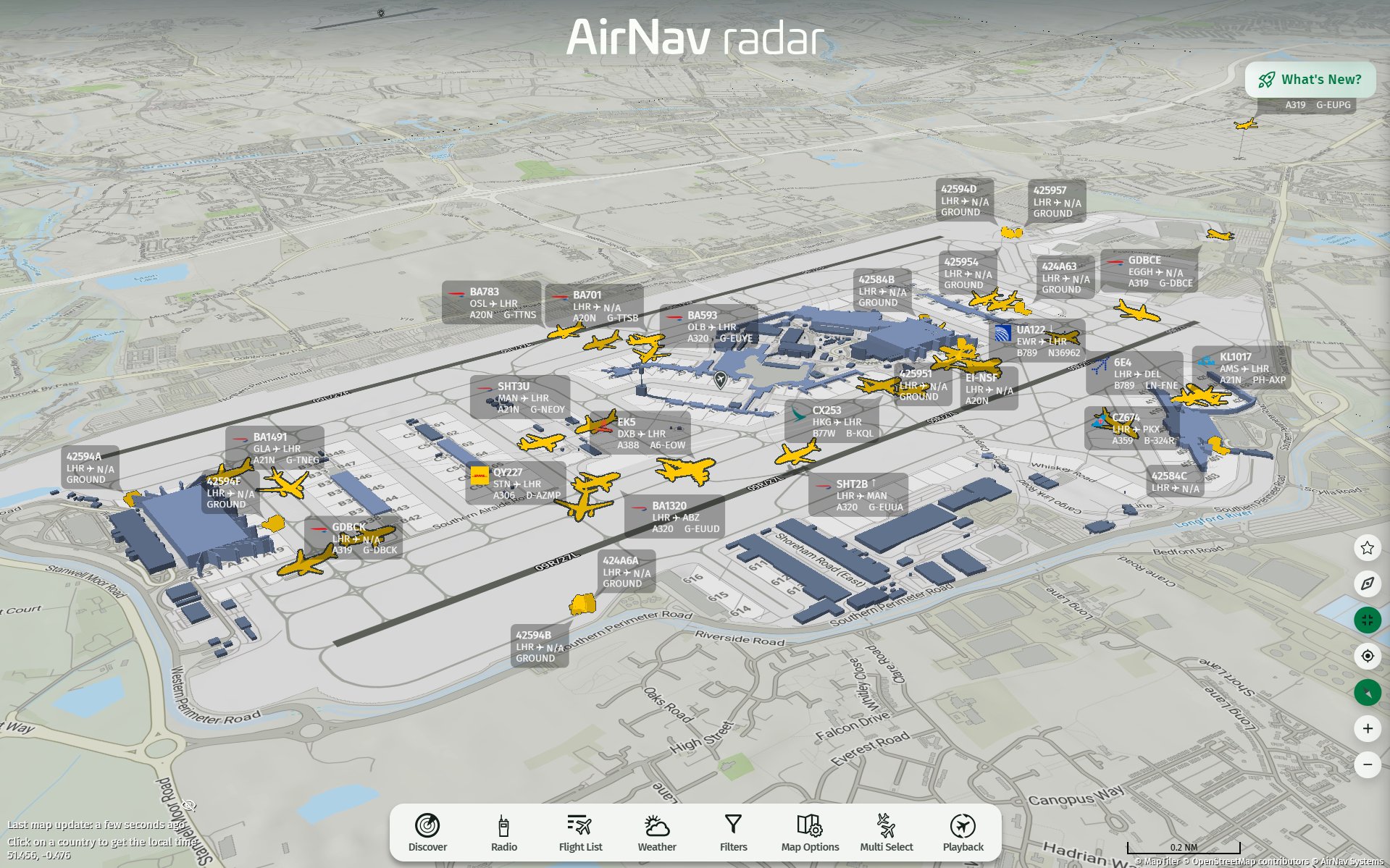
Аэропорт Хитроу в Лондоне в 3D
Независимо от того, отслеживаете ли вы рейсы через континенты, исследуете крупный аэропорт или просто наблюдаете за движением воздушного транспорта по всему миру, новый 3D-режим делает карту AirNav Radar более наглядной и увлекательной.
Взгляните на мир как на трехмерный глобус.
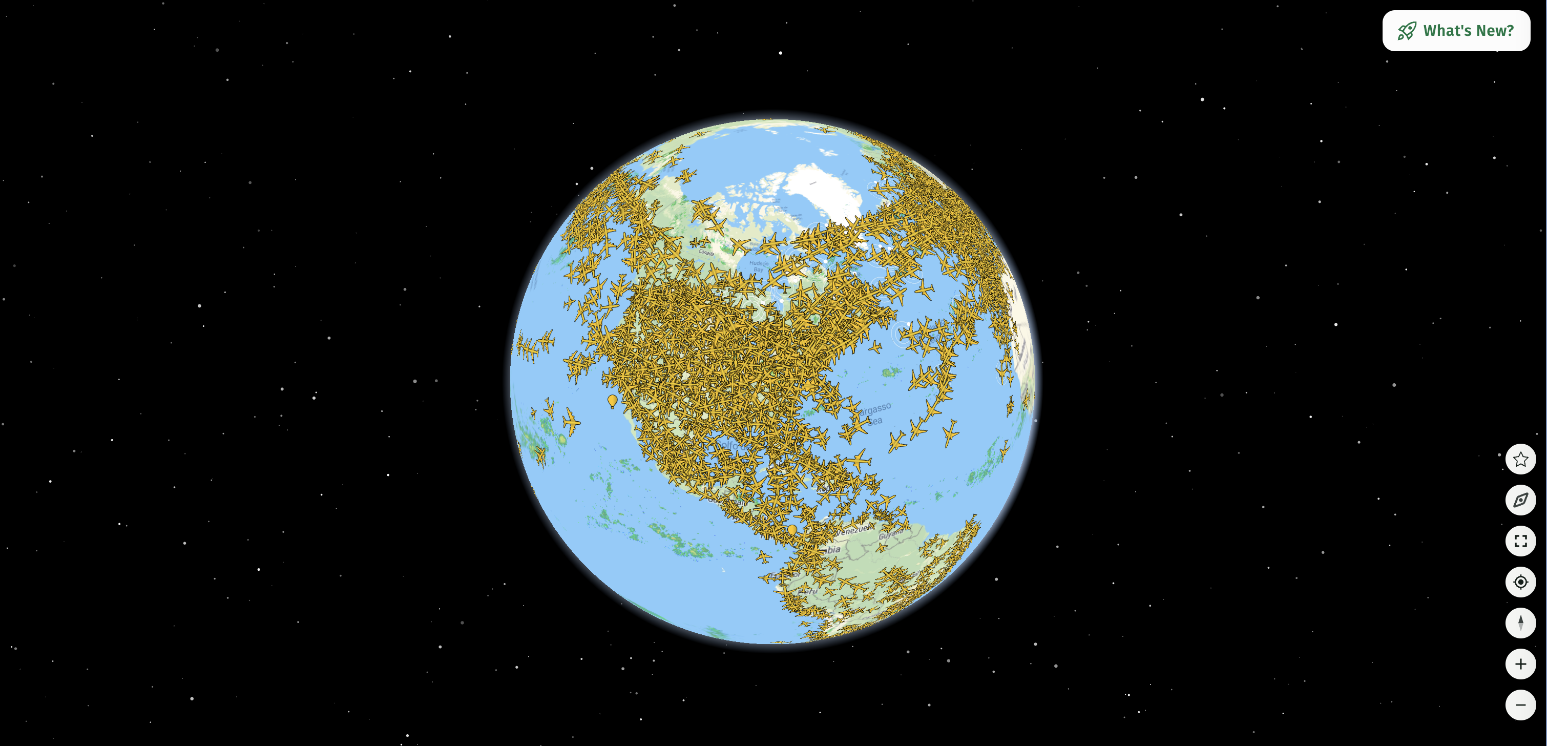
Америка в режиме 3D-глобуса
Новая опция «Глобус» преобразует карту AirNav Radar в трехмерное изображение Земли.
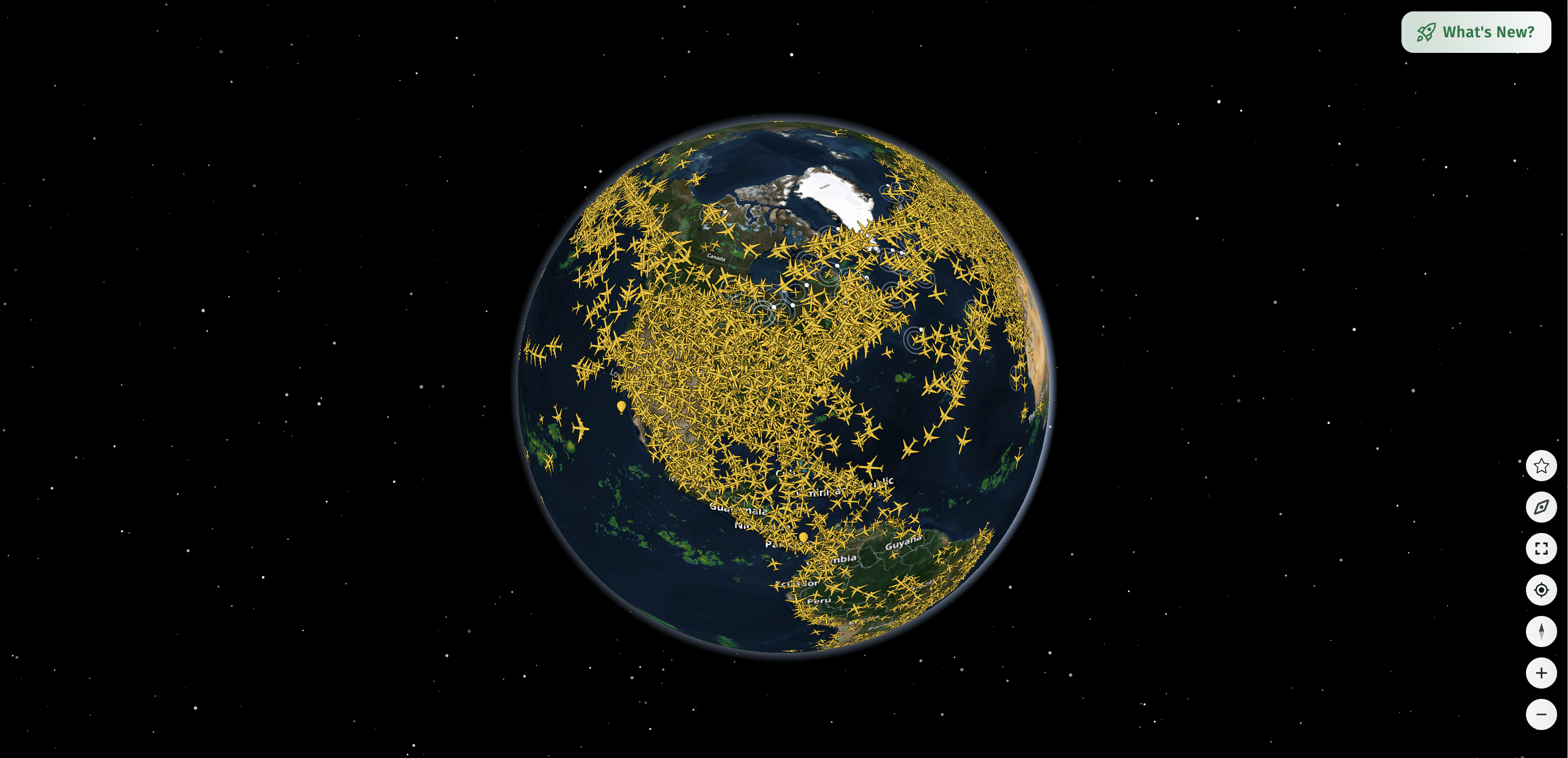
Режим 3D-глобуса со спутниковым слоем
С этого ракурса вы можете вращаться вокруг планеты, приближать изображение с глобального масштаба к конкретным регионам и изучать активность полетов по всему миру. Фон в космическом стиле дополняет впечатления, делая приложение менее похожим на традиционный трекер полетов и больше на авиационный командный центр.
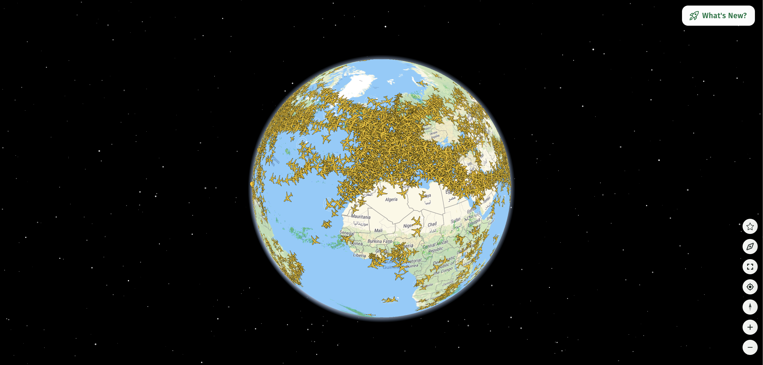
Европа в режиме 3D-глобуса
Вы можете наблюдать за движением самолетов по всему миру, отслеживая их маршруты, высоту и местоположение в режиме реального времени.
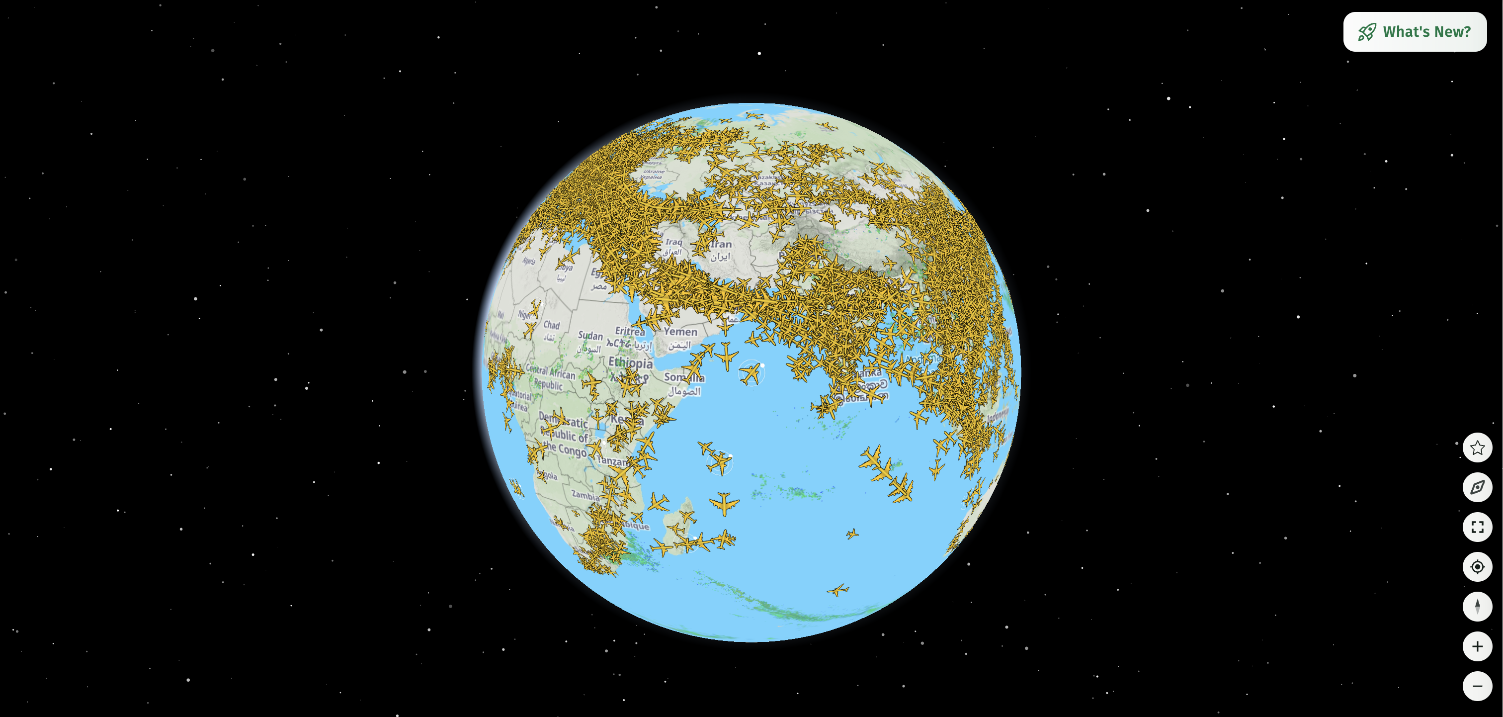
Африка, Ближний Восток и Азия в режиме 3D-глобуса
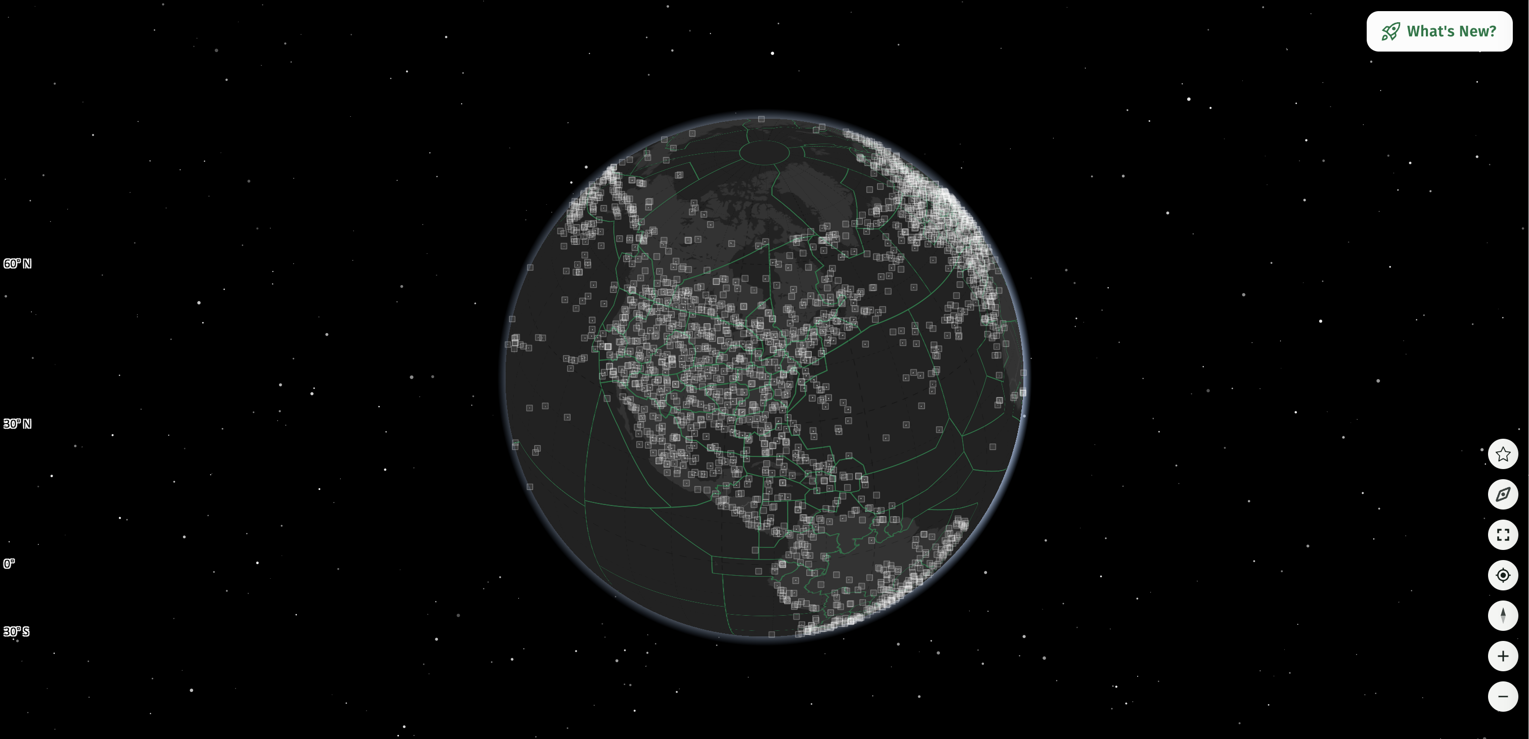
Радарный режим в 3D-глобусе
Исследуйте аэропорты в 3D.
Трехмерные функции радара AirNav позволяют пользователям исследовать аэропорты, местность и окружающий ландшафт в трех измерениях . Это дает лучшее понимание географии вокруг аэропортов и среды, в которой работают самолеты.
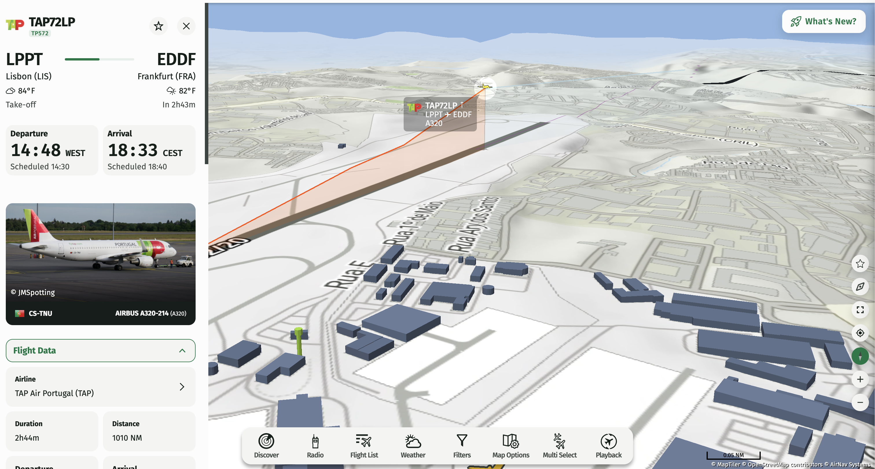
Посадка самолета в аэропорту Франкфурта с 3D-моделированием местности и режимом аэропорта.
При включении этих опций аэропорты и окружающая местность могут отображаться в 3D непосредственно на карте.
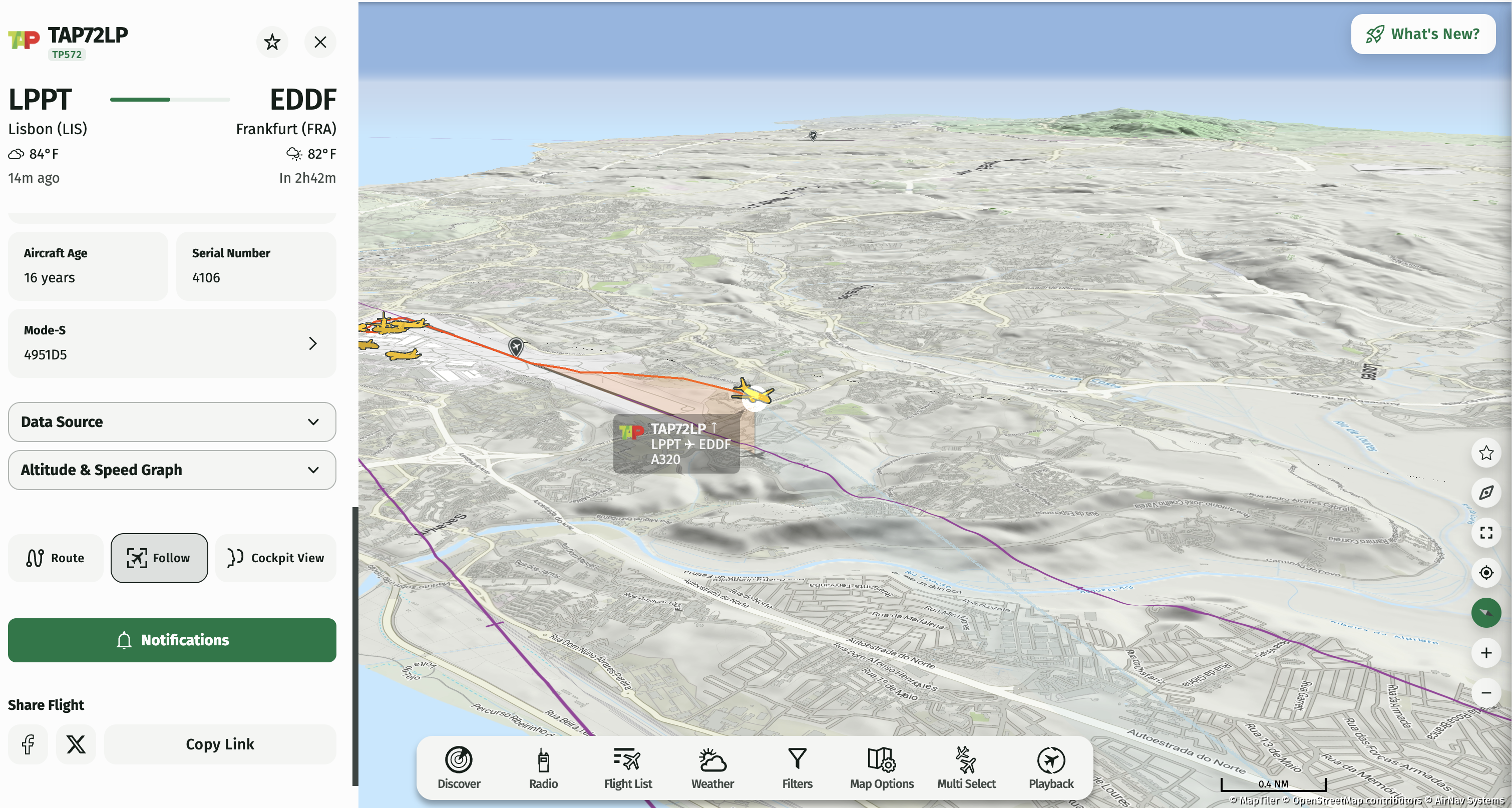
Посадка самолета в аэропорту Франкфурта с 3D-моделированием местности и режимом аэропорта.
Это особенно актуально для аэропортов, расположенных в гористых или географически сложных районах, где рельеф местности может существенно влиять на работу воздушных судов.
Следуйте по следам самолетов по всему миру.
Новая 3D-функция также оживляет траектории полета. По мере движения самолетов вы можете видеть их следы, простирающиеся по карте, что упрощает визуализацию того, где они побывали и по какому маршруту следуют.
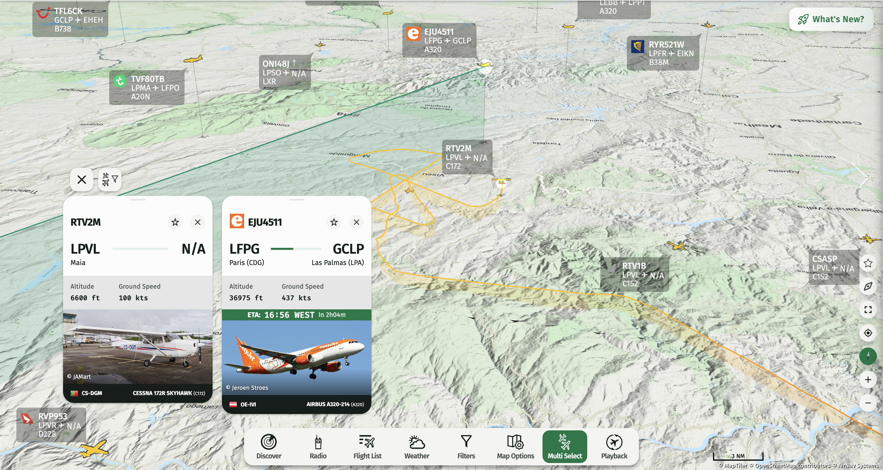
Трехмерные траектории полета
В глобальном масштабе эти маршруты создают захватывающую картину мировой авиационной активности. Приблизьте изображение, чтобы проследить за отдельными рейсами и увидеть, как развиваются их траектории вокруг аэропортов и в разных регионах.
Линии сброса с высоты
Еще один визуальный элемент, доступный в 3D-режиме, — это линии изменения высоты . Эти линии визуально отображают высоту самолета относительно земли, помогая пользователям понять вертикальное измерение полета, а не видеть положение самолета только сверху.
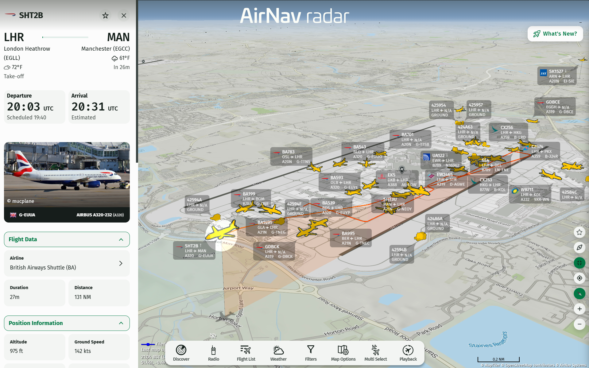
Рейс British Airways взлетает из лондонского аэропорта Хитроу: 3D-моделирование местности и режим аэропорта.
В сочетании с данными о рельефе местности и 3D-моделями аэропортов это позволяет получить гораздо более полную картину положения самолета.
Туман, ландшафт и космический фон
Трехмерный глобус — это не просто добавление третьего измерения к карте. Визуальные эффекты, такие как туман, детализированный ландшафт и космический фон, помогают создать более захватывающий опыт при перемещении по планете.
В результате получается система отслеживания полетов, которая по ощущениям гораздо ближе к реальному наблюдению за авиационной деятельностью с высоты птичьего полета.
Как включить 3D-глобус
Чтобы опробовать новый 3D-режим, достаточно всего нескольких кликов:
- Откройте веб-сайт AirNav Radar .
- Откройте параметры карты .
- Выберите глобус .
- Включить 3D .
- Включить 3D-аэропорты .
- Включите функцию «Визуализация рельефа» , чтобы отображать местность и поверхности в 3D.
- Начните исследование.
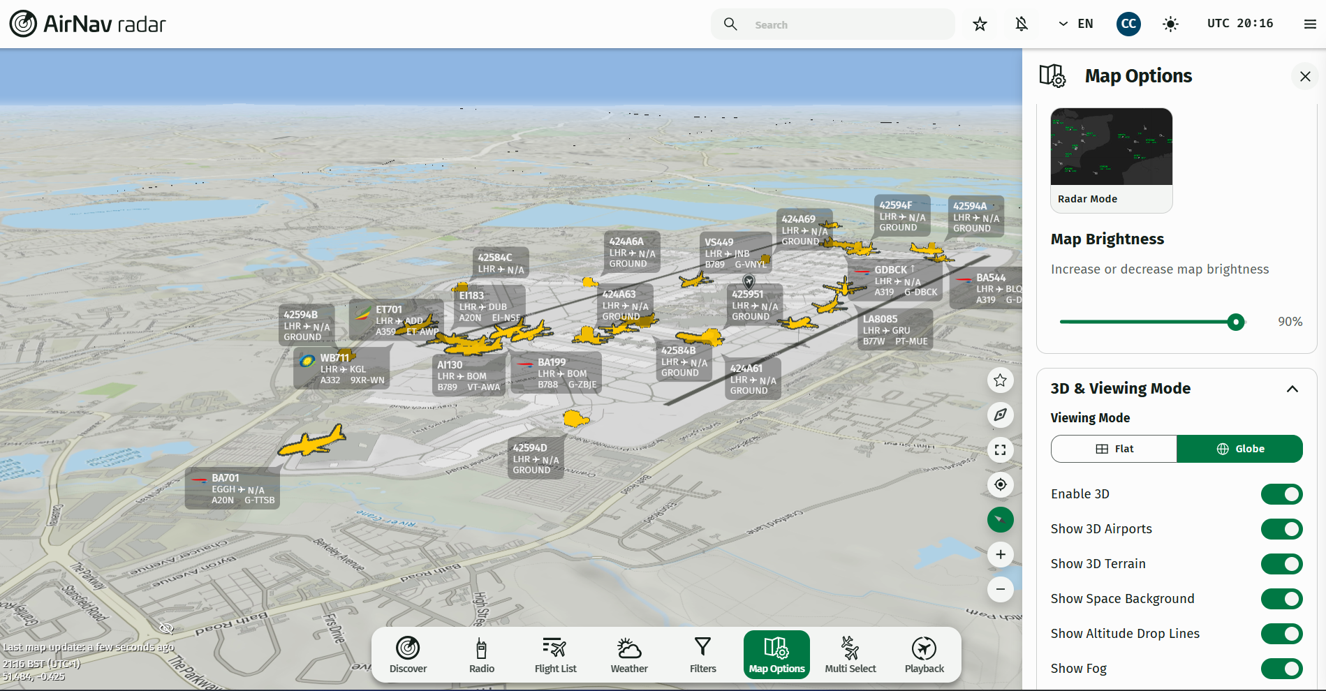
Аэропорт Хитроу в Лондоне в 3D
Как перемещаться в 3D: Чтобы вращать и исследовать 3D-карту, удерживайте клавишу Ctrl в Windows или Control (⌃) на Mac, перемещая мышь. Это позволит вам наклонять и вращать глобус, чтобы исследовать местность и поверхности с разных ракурсов.
Новый 3D-режим доступен по всему миру и позволяет исследовать аэропорты, ландшафт, траектории полета, линии снижения высоты, эффекты тумана и земной шар с совершенно новой перспективы.
После включения этой функции вы сможете вращать и масштабировать изображение земного шара, исследовать аэропорты, следить за самолетами и наблюдать за траекториями полетов с разных ракурсов.
Авиационные инциденты и события из реальной жизни
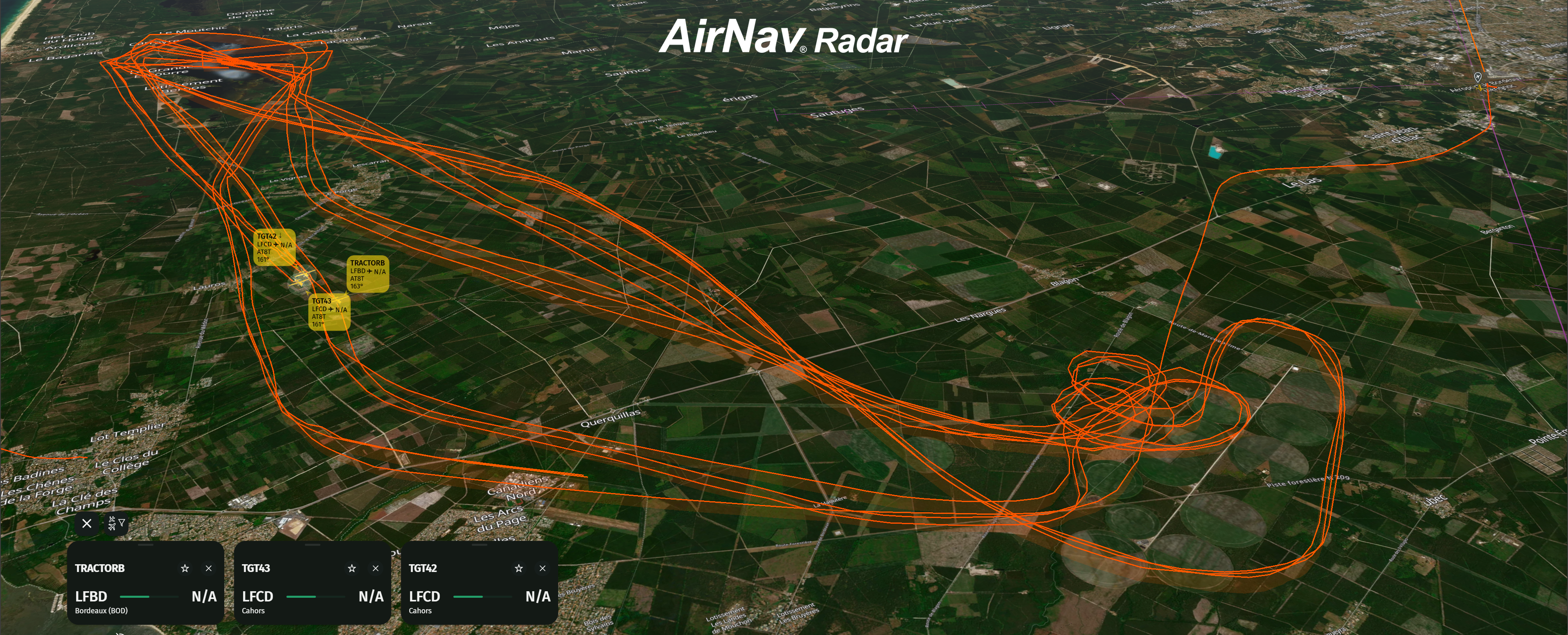
Воздушное движение вокруг Бордо в 3D
3D-режим также оживляет авиационные происшествия и реальные события, что делает его ценным инструментом для журналистов и СМИ, освещающих авиационные события. Например, пользователи могут увидеть пожарные самолеты в действии во время таких событий, как лесные пожары в Бордо, Франция, что обеспечивает более захватывающий способ следить за важной авиационной деятельностью по всему миру и визуализировать ее.
По вопросам взаимодействия со СМИ, пожалуйста, свяжитесь с нашей командой , нажав здесь.
Новый способ познакомиться с авиацией
Отслеживание полетов не обязательно должно представлять собой плоскую карту, заполненную значками самолетов. С помощью нового 3D-глобуса AirNav Radar вы можете изучать авиацию в глобальном масштабе, получая при этом гораздо более наглядное представление о географии, высоте, аэропортах и движении самолетов.
Независимо от того, являетесь ли вы заядлым наблюдателем за полетами, энтузиастом авиации, любителем наблюдать за самолетами, пилотом или просто любопытным, что происходит в небе, 3D-глобус предлагает новый способ познакомиться с мировым воздушным движением.